Intramuros is the oldest district and historic core of Manila, the capital of the Philippines. Also called the Walled City, it was the original city of Manila and was the seat of government when the Philippines was a component realm of the Spanish Empire. Districts beyond the walls were referred as the extramuros of Manila, meaning "outside the walls"
In 1564, Spanish explorers led by Miguel López de Legazpi sailed from New Spain (now Mexico), and arrived on the island of Cebu on February 13, 1565, establishing the first Spanish colony in the Philippines. Having heard of the rich resources in Manila from the natives, Legazpi dispatched two of his lieutenant-commanders, Martín de Goiti and Juan de Salcedo to explore the island of Luzon.
The Spaniards arrived on the island of Luzon in 1570. After quarrel and misunderstandings between the Islamic natives and the Spaniards, they fought for the control of the land and settlements. After several months of warfare, the natives were defeated, and the Spaniards made a peace pact with the tribal councils of Rajah Sulaiman III, Rajah Lakandula, and Rajah Matanda who handed over Manila to the Spaniards.
Legazpi declared the area of Manila as the new capital of the Spanish colony on June 24, 1571 because of its strategic location and rich resources. He also proclaimed the sovereignty of the Monarchy of Spain over the all the archipelago. King Philip II of Spain delighted at the new conquest achieved by Legazpi and his men, awarded the city a coat of arms and declaring it as: Ciudad Insigne y Siempre Leal (English: "Distinguished and Ever Loyal City"). Intramuros was settled and became the political, military and religious center of the Spanish Empire in Asia.
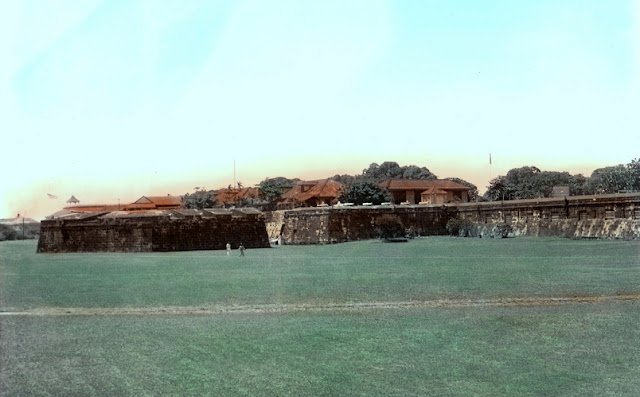
The city was in constant danger of natural and man-made disasters and worse, attacks from foreign invaders. In 1574, a fleet of Chinese pirates led by Limahong attacked the city and destroyed it before the Spaniards drove them away. The colony had to be rebuilt again by the survivors. These attacks prompted the construction of the wall. The city of stone began during the rule of Governor-General Santiago de Vera.[9] The city was planned and executed by Jesuit Priest, Antonio Sedeno and was approved by King Philip II's Royal Ordinance that was issued in San Lorenzo de El Escorial, Spain. The succeeding governor-general, Gómez Pérez Dasmariñas brought with him from Spain the royal instructions to carry into effect the said decree stating that "to enclose the city with stone and erect a suitable fort at the junction of the sea and river". Leonardo Iturriano, a Spanish military engineer specializing in fortifications, headed the project. Chinese and Filipino workers built the walls. Fort Santiago was rebuilt and a circular fort, known as Nuestra Senora de Guia, was erected to defend the land and sea on the southwestern side of the city. Funds came from a monopoly on playing cards and fines imposed on its excessive play. Chinese goods were taxed for two years. Construction of the walls began on 1590 and continued under many governor-generals until 1872. By the middle of 1592, Dasmarinas wrote the King about the satisfactory development of the new walls and fortification. Since the construction was carried on during different periods and often far apart, the walls were not built according to any uniform plan.
Improvements continued during the terms of the succeeding Governor-Generals. Governor-General Juan de Silva executed certain work on the fortifications in 1609 which was improved by Juan Niño de Tabora in 1626, and by Diego Fajardo Chacón in 1644. The erection of the Baluarte de San Diego was also completed that year. This bastion, shaped like an "ace of spades" is the southernmost point of the wall and the first of the large bastions added to the encircling walls, then of no great height nor of finished construction. It was the former site of Nuestra Señora de Guia, the very first stone fort of Manila. Ravelins and reductos were added to strengthen weak areas and serve as outer defenses. A moat was built around the city with the Pasig River serving as a natural barrier on one side. By the 18th century, the city was totally enclosed. The last construction works were completed by the start of the 19th century.
The main square of the city of Manila was Plaza Mayor (later known as Plaza McKinley then Plaza de Roma) in front of the Manila Cathedral. East of the plaza was the Ayuntamiento (City Hall) and facing it was the Governor's Palace, the official residence of the Spanish viceroyalties to the Philippines. An earthquake on June 3, 1863 destroyed the three buildings and much of the city. The residence of the Governor-General was moved to Malacañang Palace located about 3 km (1.9 mi) up on the Pasig River. The two previous buildings were later rebuilt but not the Governor's Palace.
 |
| 1851 Map of Intramuros |
Inside the walls were other Roman Catholic churches, the oldest being San Agustin Church (Augustinians) built in 1607. The other churches built by the different religious orders - San Nicolas de Tolentino Church (Recollects), San Francisco Church (Franciscans), Third Venerable Order Church (Third Order of St. Francis), Santo Domingo Church (Dominican), Lourdes Church (Capuchins), and the San Ignacio Church (Jesuits) - has made the small walled city the City of Churches.
Intramuros was the center of large educational institutions in the country. Convents and church-run schools were established by the different religious orders. The Dominicans established the Universidad de Santo Tomás in 1611 and the Colegio de San Juan de Letrán in 1620. The Jesuits established the Universidad de San Ignacio in 1590, the first university in the country, but closed in 1768 following the expulsion of the Jesuits in the country. After the Jesuits were allowed to return to the Philippines, they established the Ateneo Municipal de Manila in 1859.
 |
| The defensive walls of Intramuros |
Several bulwarks (baluarte), ravelins (ravellin) and redoubts (reductos) are also strategically located along its massive walls following the design of medieval fortifications. The seven bastions (clockwise, from Fort Santiago) are the Bastions of Tenerias, Aduana, San Gabriel, San Lorenzo, San Andres, San Diego, and Plano. The bastions were constructed at different periods of time, the reason for the differences in style. As mentioned above, the oldest bastion is the San Diego Bastion.
In Fort Santiago, there are bastions on each corner of the triangular fort. The Santa Barbara Bastion (Baluarte de Santa Bárbara) faces the bay and Pasig River; Baluarte de San Miguel, faces the bay; Medio Baluarte de San Francisco, Pasig River.
 |
| Fort Santiago Gate, Intramuros |
Fort Santiago (Spanish: Fuerte de Santiago Tagalog: Moog ng Santiago) is a citadel first built by Spanish conquistador, Miguel López de Legazpi for the new established city of Manila in the Philippines. The defense fortress is part of the structures of the walled city of Manila referred to as Intramuros ("within the walls").
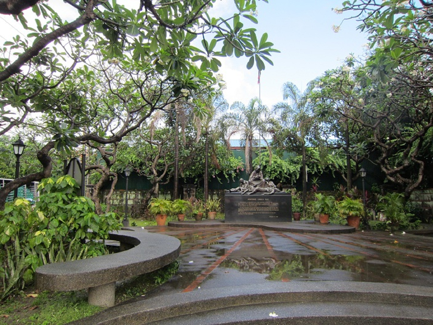
The fort is one of the most important historical sites in Manila. Several lives were lost in its prisons during the Spanish Colonial Period and World War II. José Rizal, the Philippine national hero, was imprisoned here before his execution in 1896. The Rizal Shrine museum displays memorabilia of the hero in their collection and the fort features, embedded onto the ground in bronze, his footsteps representing his final walk from his cell to the location of the actual execution.
 |
Puerta de Parian Gate, Intramuros
|
The gate was named after the "Parian de Arroceros", one of the earliest concentrations of Chinese merchants located across the city where the Metropolitan Theater now stands. Built in 1593, it is one of the earliest entrances to Intramuros. It became the official entrance of the Governor-General in 1764, following the destruction of Puerta Real during the British invasion. It was here that the newly-appointed Governor-General received the keys of the city from the Cabildo. The Parian gate was severely damaged by artillery shelling during the Battle of Manila. Restoration begun in 1967 and completed in 1982.
 |
Puerta de Isabel 11 Gate
|
The last gate to be built in Intramuros was opened in 1861 as a solution to the heavy pedestrian traffic outside Parian Gate to the Puente de Espana (Bridge of Spain) and Binondo. Located in front of it is the Queen Isabel II statue honoring the then reigning Spanish monarch. The gate became part of the route of the tranvía (streetcar) that started in 19th century Manila. It was damaged during the Battle of Manila in 1945 and restored in 1966.
 |
Puerta de Real Gate
|
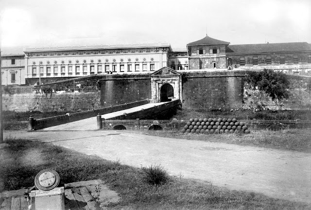
The original Real Gate (Royal Gate) was built in 1663 at the end of Calle Real de Palacio (now General Luna Street) and was used exclusively by the Governor-General for state occasions. It was located west of Baluarte de San Andres and faced the old village of Bagumbayan. It was destroyed during the British invasion of 1762 along with the removal of the village. The Puerta Real was rebuilt in 1780 and moved further west to its present location as part of the new defense plan for Intramuros. During the Battle of Manila, the gate was damaged. It was restored in 1969 with additional work made in 1989.
 |
Puerta de Parian Gate, Intramuros
|
 |
| Fort Santiago Gate, Intramuros |
 |
| Fort Santiago Gate, Intramuros |
 |
| Puerta Real Gate, Intramuros, Manila, Philippines, Late 19th or early 20th Century |
 |
Intramuros - The walled city of Manila
|
 |
| 1930's Map of Intramuros |
 |
| 2015 Map of Intramuros |
 |
| Wall of Intramuros - Cultural Heritage Monument |

Bastión de San Diego: Named after St. James the Great (aka San Iago, Santiago). Probably built around an older fortification erected by Sedeño in the late 16th century, named Nuestra Señora de Guia (Our Lady of Guidance) after a hermitage and church in Ermita, which it faced.. Presently, the bastion is an archaelogical site where three rings of stone connected by crossways were unearthed. Most opine that one of these rings was Sedeño’s fort. It is known that the fort was integrated into the Bastion between 1591-94 when Gov. Perez de Dasmariñas built the stone perimeter of the City of Manila.
 |
| Old Intramuros Wall |
 |
| Add caption |
 |
| The walls on the west side of Intramuros. Reducto de San Francisco and Baluartillo de San Francisco is in the picture. |


The existence of the fort started from Governor General Gómez Pérez Dasmariñas who integrated an older fort with cortina or curtain walls, built from 1591-1594. The bastion is a protruding structure with facing flanks built along the cortina. The purpose of its projection was to ensure a clearer view of the cortina for the artillery - in order for them to prepare against invaders. The bastion has two parts; face (which projected outward) and flanks (connecting the face and the cortina, or the curtain wall). Several developments were added in the course of time such as addition of semi-circular structures at the base called orillons or little ears making the bastion resemble an ace-of-spades shape.
Baluarte de San Diego was an ace-of-spades bastion built on the southwestern corner of Intramuros. It underwent several alterations. In 1609, a writing from Antonio de Morga states that the structure was only a tower within a much larger construction of the Fort Nuestra Señora de Guia. Jesuit priest Antonio Sedeño was the commissioned parish priest responsible for the construction of the Fort Nuestra Señora de Guia. Some of the amenities and facilities included within the fort were courtyard, cistern tank (water supply tank), lodging quarters, and workshops. However, the construction of the fort was always interrupted due to arising circumstances, thus, was not finished.
 |
| Entrance on Gen. Luna Street |
This philippine monastery was home to the augustinians. these ruins served as a wall of father blanco's garden. the san augustin church completed in 1607 is the oldest philippine stone church it was named a unesco world heritage site in 1993
One of the few surviving structures in Intramuros, Manila from the Spanish colonial period and which was still in use just over 30 years ago was the Aduana (hence the street name and its proximity to the river) building and later became the Intendencia which also at some point in time, housed the Casa Moneda