Thursday, October 05, 2017

Iligan city

 Iligan City, is a 1st class highly urbanized city in Northern Mindanao, Philippines. According to the 2015 census, it has a population of 342,618 people.

It is geographically within the province of Lanao del Norte but administered independently from the province. It was once part of Central Mindanao (Region 12) until the province was moved under Northern Mindanao (Region 10) in 2001.

Iligan has a total land area of 813.37 square kilometres (314.04 sq mi), making it one of the 10 largest cities in the Philippines in terms of land area. It had a population of 342,618 inhabitants in the 2015 census.

The name Iligan is from the Higaunon (Lumad/Native of Iligan) word "Ilig" which means "to go downstream".


History

ligan City had its beginnings in the village of Bayug, four (4) kilometers north of the present Poblacion. It was the earliest pre-Spanish settlement of native sea dwellers. In the later part of the 16th century, the inhabitants were subdued by the Visayan migrants from the island-nation called the Kedatuan of Dapitan, on Panglao island.

In the accounts of Jesuit historian Francisco Combes, the Mollucan Sultan of Ternate invaded Panglao. This caused the Dapitans to flee in large numbers to a re-established Dapitan, Zamboanga del Norte.

In Dapitan, the surviving Datu of Panglao Pagbuaya, received Legazpi's expedition in 1595. Later, Pagbuaya's son Manook was baptized Pedro Manuel Manook. Sometime afterwards in by the end of the 16th century after 1595 Manook subdued the higaunon (animist) village of Bayug and turned it into one of the earliest Christian settlements in the country. The settlement survived other raids from other enemies, especially Muslims of Lanao, and the early Iliganons moved their settlement from Bayug to Iligan, which the Augustinian Recollects founded as a mission in 1609.

Spanish era

The Jesuits replaced the Recollects in 1639. Iligan was the Spaniards' base of operations in attempting to conquer and Christianize the Lanao area throughout its history. A stone fort called Fort St. Francis Xavier was built in 1642 where Iliganons sought refuge during raids by bandits. But the fort sank due to floods. Another fort was built and this was named Fort Victoria or Cota de Iligan.

In 1850, because of floods, Don Remigio Cabili, then Iligan's governadorcillo, built another fort and moved the poblacion of the old Iligan located at the mouth of Tubod River west of the old market to its present site.

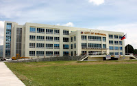
Camp Overton in 1900, an American Armybase, currently the location of Global Steel Philippines Inc.
Iligan was already a town of the once undivided Misamis Province in 1832. However, it did not have an independent religious administration because it was part of Cagayan de Oro, the provincial capital. It was one of the biggest municipalities of Misamis Province.

The Spaniards abandoned Iligan in 1899, paving the way for the landing of the American forces in 1900.

 American era

In 1903, the Moro Province was created. Iligan, because of its Moro residents, was taken away from the Misamis Province. Then Iligan became the capital of the Lanao District and seat of the government where the American officials lived and held office. Later in 1907 the capital of the Lanao District was transferred to Dansalan.

In 1914, under the restructuring of Moroland after the end of the Moro Province (1903–1913), Iligan became a municipality composed of eight barrios together with the municipal district of Mandulog. After enjoying peace and prosperity for about 40 years, Iligan was invaded by Japanese forces in 1942.

The liberation in Iligan by the Philippine Commonwealth forces attacked by the Japanese held sway in the city until 1944 to 1945 when the war ended. On November 15, 1944, the city held a Commonwealth Day parade to celebrate the end of Japanese atrocities and occupation.

Cityhood

Using the same territorial definition as a municipality, Iligan became a chartered city of Lanao del Norte on June 16, 1950. It was declared a first class city in 1969 and was reclassified as First Class City "A" on July 1, 1977 by virtue of Presidential Decree No. 465. In 1983, Iligan was again reclassified as a highly urbanized city.

Lone district
Republic Act No. 9724, an Act separating the City of Iligan from the First Legislative District of the Province of Lanao del Norte was approved by President Gloria Macapagal Arroyo on October 20, 2009.

Geography

Iligan City is bounded on the north by the 3 municipalities of Misamis Oriental (namely Lugait, Manticao and Opol), to the south by the 3 municipalities of Lanao del Norte (Baloi, Linamon and Tagoloan) and the 2 municipalities of Lanao del Sur (Kapai and Tagoloan II), to the north-east by Cagayan de Oro City, to the east by the municipality of Talakag, Bukidnon; and to the west by Iligan Bay.

To the west, Iligan Bay provides ferry and container ship transportation. East of the city, flat cultivated coastal land gives way to steep volcanic hills and mountains providing the waterfalls and cold springs for which the area is well known.

Demographics

Iligan is predominantly Christian (93.61%). Iliganons are composed of a Cebuano-speaking majority and local minorities mainly Maranaos and Higaonons.

Some Tagalogs, other cultural minorities and immigrants from other places also inhabit Iligan. It is not only rich in natural resources and industries but it is also the home of a mix of cultures: the Maranaos of Lanao, the Higaonon of Bukidnon, and many settlers and migrants from other parts of the country. It is known for its diverse culture.

Language
Cebuano is the major language in the city (92.27%). The rest speak Maranao, Tagalog, Hiligaynon, Ilocano, Chavacano, and Waray-Waray. The majority of the population can speak and understand English.

Economy

Iligan is known as the Industrial Center of the South and its economy is largely based on heavy industries. It produces hydroelectric power for the Mindanao region through the National Power Corporation (NAPOCOR), the site of the Mindanao Regional Center (MRC) housing Agus IV, VI and VII hydroelectric plants. It also houses industries like steel, tinplate, cement and flour mills.

After the construction of Maria Cristina (Agus VI) Hydroelectric Plant by National Power Corporation (NPC, NAPOCOR) in 1950, the city experienced rapid industrialization and continued until the late 1980s. The largest steel plant in the country, National Steel Corporation (NSC), was also established in 1962.

During the 1997 Asian Financial Crisis, the city experienced severe economic slowdown. A number of industrial plants were closed, notably the National Steel Corporation.

The city made its economic revival with the reopening of the National Steel Corporation, renamed Global Steelworks Infrastructures, Inc. (GSII) in 2004.[18] On October 2005, GSII officially took a new corporate name: Global Steel Philippines (SPV-AMC), Inc.

Wednesday, October 04, 2017

Guihulngan City


Guihulngan City is a 5th class city in the province of Negros Oriental, Philippines. According to the 2015 census, it has a population of 95,969 people, the third-most populous city in Negros Oriental after the cities of Dumaguete and Bayawan.

History

There are several versions how the city derived its name. The first, according to old tales, was attributed to a river flowing directly to the town proper from the main spring in sitio Anahaw, Barangay Nagsaha, hence the name "GUIPADULNGAN" which means the point where the river flows to an end.

The second is associated with the gruesome incident in the 19th Century when the Philippines was a colony of Spain; men and women of different ages were said to be captured, beheaded and thrown into the sea by the Moros, now known as Tañon Strait. Other accounts claim that the Moro invaders dropped a bell into the sea when they found out that it was used by the lookout to warn the townsfolk of their coming. Since that time, the place has been called "GUIHULUGAN" which means, "Place where a thing was dropped". But in the Spanish writing, "U" and "N" are similar, which is why it became commonly written and known as GUIHULNGAN.

Whether it originated as "GUIPADULNGAN" or "GUIHULNGAN", the name is indeed symbolic, as the town is “dropped” with abundant blessings from the Almighty for a significant "end".

Cityhood

During the 11th Congress (1998–2001), Congress enacted into law 33 bills converting 33 municipalities into cities. However, Congress did not act on a further 24 bills converting 24 other municipalities into cities.

During the 12th Congress (2001–2004), Congress enacted into law Republic Act No. 9009 (RA 9009), which took effect on 30 June 2001. RA 9009 amended Section 450 of the Local Government Code by increasing the annual income requirement for conversion of a municipality into a city from ₱20 million to ₱100 million. The rationale for the amendment was to restrain, in the words of Senator Aquilino Pimentel, "the mad rush" of municipalities to convert into cities solely to secure a larger share in the Internal Revenue Allotment despite the fact that they are incapable of fiscal independence.

After RA 9009 went into effect, the House of Representatives of the 12th Congress adopted Joint Resolution No. 29, which sought to exempt from the ₱100 million income requirement in RA 9009 the 24 municipalities whose cityhood bills were not approved in the 11th Congress. However, the 12th Congress ended without the Senate having approved Joint Resolution No. 29.

During the 13th Congress (2004–2007), the House of Representatives re-adopted former Joint Resolution No. 29 as Joint Resolution No. 1 and forwarded it to the Senate for approval. However, the Senate again failed to approve the Joint Resolution. Following the suggestion of Senator Aquilino Pimentel (Senate President), 16 municipalities filed, through their respective sponsors, individual cityhood bills. The 16 cityhood bills each contained a common provision exempting it from the ₱100 million income requirement of RA 9009 –

"Exemption from Republic Act No. 9009. — The City of x x x shall be exempted from the income requirement prescribed under Republic Act No. 9009."

On 22 December 2006, the House of Representatives approved the cityhood bills. The Senate also approved the cityhood bills in February 2007, except that of Naga, Cebu which was passed on 7 June 2007. These cityhood bills lapsed into law on various dates from March to July 2007 after President Gloria Macapagal-Arroyo failed to sign them.

Guihulngan was already the largest municipality in Negros Oriental when, in July 2007, a popular referendum was passed declaring it a city.[5]The point of law at issue in 2007 was whether there had been a breach of Section 10, Article X of the 1987 Constitution, which provides –

No province, city, municipality, or barangay shall be created, divided, merged, abolished or its boundary substantially altered, except in accordance with the criteria established in the local government code and subject to approval by a majority of the votes cast in a plebiscite in the political units directly affected.

– and in each case the established criteria were far from met.

In November 2008, Guihulngan and 15 other cities lost their cityhood after the Supreme Court of the Philippines granted a petition filed by the League of Cities of the Philippines, and declared unconstitutional the cityhood law (RA 9409) which had allowed the town to acquire its city status. The Supreme Court ruled that they did not pass the requirements for cityhood.

On 10 December 2008, the 16 cities affected acting together filed a motion for reconsideration with the Supreme Court. More than a year later, on 22 December 2009, acting on said appeal, the Court reversed its earlier ruling as it ruled that "at the end of the day, the passage of the amendatory law" (regarding the criteria for cityhood as set by Congress) "is no different from the enactment of a law, i.e., the cityhood laws specifically exempting a particular political subdivision from the criteria earlier mentioned. Congress, in enacting the exempting law/s, effectively decreased the already codified indicators. Accordingly cityhood status was restored.

But on 27 August 2010, the 16 cities lost their city status again, after the Supreme Court voted 7-6, with two justices not taking part, to reinstate the 2008 decision declaring as "unconstitutional" the Republic Acts that converted the 16 municipalities into cities. A previous law required towns aspiring to become cities to earn at least ₱100 million annually, which none of the 16 did.

On 15 February 2011, the Supreme Court made another volte-face and upheld for the third time the cityhood of 16 towns in the Philippines.

Finally, on 12 April 2011, the Supreme Court, in an en banc ruling delivered in Baguio City, affirmed the finality of the constitutionality of the 16 cityhood laws by resolving that:

We should not ever lose sight of the fact that the 16 cities covered by the Cityhood Laws not only had conversion bills pending during the 11th Congress, but have also complied with the requirements of the LGC prescribed prior to its amendment by R.A. No. 9009. Congress undeniably gave these cities all the considerations that justice and fair play demanded. Hence, this Court should do no less by stamping its imprimatur to the clear and unmistakable legislative intent and by duly recognizing the certain collective wisdom of Congress. WHEREFORE, the Ad Cautelam Motion for Reconsideration (of the Decision dated 15 February 2011) is denied with finality.

On 28 June 2011 the Supreme Court directed the Clerk of Court to issue the entry of judgment on the cityhood case of 16 municipalities.

Tuesday, October 03, 2017

Gingoog City

Geographical location

The city is located on the northeastern coast of the Province of Misamis Oriental, Region 10. It is 122 kilometers from the regional center of Cagayan de Oro City and 74 kilometers West of Butuan City. It lies within the grid coordinates 124°57” East Longitude and 8°52” North Latitude. It is bounded on the North by Gingoog bay; on the East by the Municipality of Magsaysay and the Province of Agusan del Norte; on the West by the Municipalities of Claveria and Medina and on the South by Agusan del Sur.

The city occupies an area of 769.88 square kms. (76,988 hectares)

History

Looking back in pre-Hispanic era, Gingoog originates from a thriving Manobo settlement in the area presently situated by Barangay Daan Lungsod. With influx of migrants as years passed, the settlers decided to transfer to a wider area for settlement.

A spacious or wider area with room for growth and expansion was considered by the settlers at Gahub-Mangiskis, beside the river and the seashore.

Gingoog became a Spanish pueblo in 1868 and became a municipality in 1903 under the United States administration. During this period the town’s economic growth was spurred by agricultural development and the benefits of forest product/wood-based production by then Sta. Clara and thence Anakan Lumber Company logging operations and the Mindanao Plywood Corporation.

On June 18, 1960 Gingoog became a Charter City. From third Class, Gingoog city became First Class city in 1982 and continued on to be adjudged Most Outstanding Component City of Region 10 in 1984.

Before the city was served its light and power needs by MORESCO II on December 17, 1978, CEPALCO, a private service firm cater to the city’s needs until the former withdraw its services for reasons leaving the latter experiencing dark nights.

A decade later, the city saw the massive rural road development program connecting circumferential al-weather and dirt roads at least connecting remote barangays to the main routes to the city. Rural electrification has also started that gained momentum in the start of the 21st Century that presently hundred per cent of the rural barangays are “switched on”.

During the period also, the forest product or wood-based companies have ceased operations in the city while the city wharf services also was gone as boats stop calling port as shippers preferred the proliferating services of the “door to door” delivery container vans from the ports of Cagayan de Oro and Nasipit.

The proposed Gingoog River Mini Hydro Project was already hatched and has been toying in the dreams and aspirations of past and present leaders with complete pre-FS documents and series of technical surveys of the area proposed. The idea has always become a political issue each and every election year each making the electorate callused or incentive dismissing it as mere propaganda as nothing actually happened.

At present, towards 2010 and onward, the city’s stance is to develop the potentials of the areas of tourism. It was painfully accepted that with the absence of drivers for vigorous industries and manufacturing ventures, the city is unable to compete with the highly urbanized neighbors who ere strategically located at the gates of transport networks for commerce and industry.

In that direction, the present administration is vent on installing tourist-oriented facilities and infra-supports while offering tax incentives to potential investors. Much effort was exerted and resources directed towards identifying potential area for economic growth in that stance. The laudable efforts of the current LCE has greatly changed the facade and overlaying suburbs signifying shift and change and sent positive signal to investors that friendly environs for investment has actually been manifest.


Climate

Based on PAGASA data, the hottest month is observed in May with an average temperature of 28.95ºC while the month of January is the coolest with an average temperature of 26.60 ºC.

In terms of surface wind circulation pattern, oceanographic data reveals that the coast of Gingoog is greatly influenced by the monsoon systems, namely, the Northeast Monsoon System (November to March) and the Southwest Monsoon System (June to October). Of these systems, the Northeast Monsoon greatly affects the coast and the wind-driven circulation of the bay seems to be directed towards the coast.

Monday, October 02, 2017

General Santos City Hall

General Santos City is a 1st class highly urbanized city in Soccsksargen, Philippines. According to the 2015 census, it has a population of 594,446 people.

Located on the island of Mindanao, it is the southernmost and 15th-most populous city in the Philippines. It is the regional center for commerce and industry of the Soccsksargen region, and is geographically located within the province of South Cotabato but administered independently of it.

Formerly known as Dadiangas, city is named after Gen. Paulino Santos, a former Commanding General of the Philippine Army, and the settlement's leading pioneer.


History

The nomadic B'laan people are the original inhabitants of General Santos, and traces of their early settlement of the area are found in the city's place names, which are derived from their vocabulary. Their name for the city, Dadiangas, is from the thorny Ziziphus spina-christi tree that was once abundant in the area and is now a protected species under Republic Act 8371 or the Indigenous Peoples Right Act of 2007. The B'laan tribe presently lives alongside the city's new generation of settlers and other immigrants.

Waves of Migration

Organized under the National Land Settlement Administration (NLSA) of the Commonwealth Government headed by President Manuel L. Quezon, General Paulino Santos led the relocation of 62 Christian settlers from Luzon to the shores of Sarangani Bay aboard the steam ship “Basilan” of Compañia Maritima on February 27, 1939. The 62 pioneers, mostly agricultural and trade graduates, were the first large batch of settlers to land in the area with the mission to industriously cultivate the region. After this first influx of pioneers, thousands more Christians from Luzon and the Visayas have subsequently moved into the area, gradually driving some of the resident B'laan to the mountains, who have lost their livelihood.

In March 1939, the first formal settlement in the city was established in Alagao, which is now known as Barangay Lagao. Lagao district was known then as the "Municipal District of Buayan" under the jurisdiction of the deputy governor of the Municipal District of Glan. Until it officially became an independent Municipal District of Buayan on October 1, 1940, appointing Datu Sharif Zainal Abedin—an Arab mestizo married to a daughter of a very influential datu of lower Buayan—as the first district municipal mayor.

Second World War

During the Second World War, the Municipal District of Buayan become one of the last frontiers between the combined American and Filipino forces and troops from the Empire of Japan. Retreating Imperial Japanese forces made Klaja Karsts Land their last ground for defence, constructing round cement bunkers and tunnels. These bunkers can still be seen at Sitio Guadalupe; most of the tunnels, however, have since been damaged and even destroyed by treasure hunters and land developers.


Renaming and elevation to city status

A year after the Philippines regained full sovereignty from the United States on July 4, 1946, the Municipality of Buayan became a 4th class regular municipality by virtue of the Executive Order Number 82, dated August 18, 1947 by President Manuel Roxas, absorbing the Municipal District of Glan whose low income bracket at the time disqualified it for the honour. Dadiangas was the seat of government for the Municipality of Buayan electing Irineo Santiago as its first Municipal Mayor on a local election that was held on November 11, 1947. Mayor Santiago was formally inducted on January 1, 1948.

Six years later, in June 1954, the Municipality of Buayan was renamed General Santos as a tribute to the leading pioneer via Act No. 1107[6] authored by Congressman Luminog Mangelen of Cotabato Province.


From 1963 to 1967, the municipality's economy experienced a boom under Mayor Lucio A. Velayo, as several large agri-based and multinational firms such as Dole Philippines, General Milling Corporation and UDAGRI expanded into the area. Although it was then qualified to become a fourth class city from being a municipality, the residents rejected a move by Congressman Salipada Pendatun to convert the Municipality of Buayan into a city and to rename it ’’Rajah Buayan’’.

On July 8, 1968, the Municipality of General Santos was converted into a city upon the approval of Republic Act No. 5412, authored by Congressman James L. Chiongbian. It was inaugurated on September 5 of that year, with Antonio C. Acharon became the new city's first mayor. On the 5th of September in the year 1988, A decade after its inauguration as a chartered city, GenSan was declared a highly urbanized city of South Cotabato.


Geography

General Santos City lies at the southern part of the Philippines. It is located at 6°7'N 125°10'E latitude. The city is southeast of Manila, southeast of Cebu and southwest of Davao.

The city is bounded by municipalities of Sarangani Province namely Alabel in the east, and Maasim in the south. General Santos is likewise bounded by the South Cotabato municipality of Polomolok and Sarangani Province municipality of Malungon in the north, and the municipality of T'boli in the west.

Climate

General Santos City has a tropical wet and dry climate (Köppen climate classification Aw). It is considered to be one of the driest places in the Philippines, even with a less pronounced dry season.

There are two major languages spoken in the city, with Cebuano being widely spoken and being used by the local media outlets in the city (Television, radio, and newspapers) followed by Ilonggo, which is used mainly by settlers who came from the provinces of South Cotabato, Sultan Kudarat, North Cotabato and Maguindanao, as well as immigrants from the provinces of Negros Occidental, Iloilo and Guimaras.

Religion

The predominant religion in the city is Christianity, with the largest denomination being the Catholic Church, comprising almost 90 percent of the population. Some 8 percent self-identified as belonging to one of several Protestant churches, including the Aglipayan Church, the Seventh-day Adventist Church, Jehovah's Witnesses, and various Alliance, Baptist, Born Again, Church of God, Evangelical, Methodist and Pentecostal groups. Included also in this percentage is the Iglesia ni Cristo.

The remaining 2 percent belong to non-Christian faiths, particularly Islam.


Economy

The city's major economic activity is primarily anchored in two sectors namely the agro-industry and fishing industry.

Agro-Industry

 Endowed with rich volcanic soil, ample and well distributed rainfall all throughout the year and a typhoon-free climate, General Santos City produces export quality high valued crops such as corn, coconut, pineapple, asparagus, banana and rice. It also yields quality exotic fruits, vegetables and cut flowers. The city is also a top producer and exporter of quality livestock such as poultry, hogs, and cattle. But with the continuing growth in population and economy in the passing of time, a number of the city's agricultural lands have gradually been converted into built up areas in order to address the relatively growing need of dwelling and viable spaces.

Fishing Industry

 General Santos City is the largest producer of sashimi-grade tuna in the Philippines.Thus in as early as 1970, the title "Tuna Capital of the Philippines" has become a tag to it. GenSan also accounts for the second largest daily total catch of fish in the country after Navotas City in the National Capital Region. Locals in the city boast that fishes and seafoods do not come fresher than what is found in their locality. The fishing industry in GenSan yields a total daily capacity of 750 metric tons of fish catch alone and employs about 7,800 workers. Which is why General Santos City is home to seven (7) tuna processing plants in the country. The Fishport Complex in Barangay Tambler has a 750 metres (2,460 ft) quay and a 300 metres (980 ft) wharf for 2,000 GT reefer carriers. The fishport is equipped with modern facilities that comply with international standards on fish catch handling.
General Santos City has registered 1,365 new medium to large enterprises in 2011. An aggregate investment involved is estimated PHP 1.202 billion. Top industry for new investment in 2011 are as follows: Hotel and Restaurant-31%; Wholesale & Retail Trade-20%; Repair of Motor Vehicles, Motorcycles and Personal & Household Goods, Real Estate & Renting Business Activities-17%; Other Community, Social & Personal Services-8%; Financial Intermediation-5%; Manufacturing-5%; Fishing-3%; ICT-3 %

As of 2000, there are 59 banks serving the city. This composed of 46 commercial banks, 5 savings banks, 7 rural banks and 1 cooperative bank. Aside from this, there are 48 lending institutions as well as 49 pawnshops providing emergency loan assistance.


Shopping

General Santos City is the shopping capital of the Soccksargen region. Residents from nearby towns and provinces visit the city to do shopping and enjoy life and leisure activities. There are several huge shopping malls in the city, notable ones are KCC Mall of Gensan, SM City General Santos, Robinsons Place GenSan, Gaisano Mall of GenSan, RD Plaza (Fitmart), Veranza Mall, and the newest addition to the city which is RD City Mall located at Brgy. Calumpang and Unitop Shopping Mall in Brgy. Dadingas West. SM Savemore has two branches in the city and another branch will be built within the downtown area. There are also news about building an Ayala Mall and Puregold. These malls are home to both national and international brands of retail merchandises as well as restaurants and cafes. There are many merchandise and large groceries owned by local and foreign Chinese, Taiwanese and Korean businessmen in the city.

Sunday, October 01, 2017

Gapan City

History
The city of Gapan is one of the component cities of Nueva Ecija today that is at the forefront of the national effort to insure social and economic advancement. Gapan is now considered as the footwear capital of the north. Also it is an inseparable part of the Rice Granary of the Philippines.

Gapan was organized by the Spanish curates and officials who in their early occupation, exercised great influence over the people and the things they were doing, History places Gapan as one of the first towns of Pampanga founded sometime in the middle part of the sixteenth century. Records of the first Catholic Mission to the fareast indicated that in 1595 Fathers Contreas Tendilla, Caballo and Salazar were responsible for clearing the forest which later became a Pueblo. In this Pueblo were constructed a church, presidencia and residential houses made of bricks and lime constituted age old Landmarks of the town.

Historical data recorded that Gapan was founded in 1595 making it the oldest town in Nueva Ecija and one of the oldest in the Philippines. It was likewise a big Pueblo embracing an area as far as Cabanatuan City in the north, which was its barrio with the name Cabanatuan before it separated in 1777: the Sierra Madre in the East, San Miguel, Bulacan in the South and Candaba, Pampanga in the West. Gradually as the Spanish power waned an economic progress caught up in the area, the pueblo disintegrated into many pueblos until it remained to comprise only the towns of Penaranda, General Tinio and San Leonardo ( formerly called Manikling) all of Nueva Ecija province. In fact the Patron Saint Divina Pastora had its origin or residence in Barrio Callos. Penaranda.

Extant record had this town called “Ibon” and how to come to be known as Gapan has its interesting legend it has already been intimated that this place was formerly a wilderness. At a time it was so, some Spanish soldier on certain mission came here when they saw natives crawling through the thick bushes .The soldier halted them and not knowing the local dialect asked in Spanish for the name of the town. The natives know nothing of the Spanish Language and thinking that the Spanish were asking what they were doing answered in Tagalog a local dialect “Gumagapang gapang kami” The Spanish took it as a name and henceforth called The Pueblo Gapang. In due time, the letter “g” was dropped and the more finesse name Gapan stick to this day. Another legend stated the name came from the climbing and crawling plants that were so numerous in the locality.

Originally, the town had eight barrios namely, Sta Cruz, Mangino, Pambuan, San Lorenzo, San Vicente, San Nicolas, Sto Cristo and San Roque or Baluarte, with San Lorenzo and San Vicente constituting the poblacion of the Municipality. Thirteen additional Barrios or Barangay were established by then Municipal council or under the charter and they are Bungo, Kapalangan, Puting Tubig, Makabaklay,Maburak Sto Nino, Bayanihan, Sto Cristo Norte, Malimba, Mahipon, Bulak, Parcutela and Marelo.

The Church of Gapan is made of Bricks, Adobe and Lime. The architecture is Byzantine and was constructed under the successive direction and supervision of Father Loredo,Conejo and Llaneza for a period of about sixteen years, that is 1856-1872. Like most of gigantic building done during the Spanish regime, the church was built through forced labor. The materials used were taken from Laryuhan in Barrio San Vicente and from Barrio San Lorenzo near Pambuan to bring the material to the site of the church, laborers had to line themselves straight between the sources of materials and site of construction and had to pass the bricks from one hand to another. Records show that since 1740, Gapan has “ Cura Parrocos” beginning with father Francisco Medalla. Hence it is also right to assess that the Catholic Church of Gapan is now over two centuries old.

The City has two Patron Saints, the Three Kings and the Divine Shepherdess. The feast for the Three Kings is every sixth day of January and the Divine Shepherdess is every first of May, these was the Official City Fiesta as declared by then municipal council by an ordinance. This fact accounted for Gapan City to become a place of Pilgrimage for devotees in Central Luzon The miracles of the Divine Shepherdess has attracted the attention of the church authorities that on April 26, 1964, she was crown queen at the church plaza thereby making Gapan an official pilgrimage city where her graces would flourish for those who visit Gapan in the same manner that the Virgin of good voyage would lavish for those who go on pilgrimage to Antipolo City.

One of the eight rays in the Filipino flag represent Nueva Ecija as one of the eight provinces which took up arms against Spain, participants in this uprising came from Gapan, San Isidro, Cabiao and Penaranda led by General Pantaleon Valmonte ( mentioned as Belmonte in history ) Gapan contributed thirteen heroes of martyr killed by the Spaniards They were Epifanio Ramos, Quintin Tinio, Faustino Delos Reyes, Leocadia Liwag, Valentin Liwag, Severino Changco, Saturnino Magno and Ramon Tinawin .In due recognition of their patriotic sacrifices Gapan City government had given due honors by erecting a monument at the San Vicente Plaza called “Inang Bayan” where their names were engraved and by naming the streets in the city proper after them.

The City of Gapan acquired corporate existence in the ratification of its creation by a majority of votes cast by the qualified voters in a plebiscite conducted last August 25, 2001. By virtue of Republic Act no. 9022 sponsored by Congresswoman Julita Lorenzo Villareal, Gapan was converted into a component city.

The City of Gapan held tremendous promise not only in its natural resources but also in its potentials in agri-base industries and in footwear industries which help sustain its vital role in agricultural and industrial production. Commercial and trade activities in the city are further accelerated by the influx of financial lending institution and new businesses

City of Gapan is located in the South Eastern part of Nueva Ecija. It is bounded on the North by the Municipality of San Leonardo, on the East by the municipalities of Penaranda and Gen. Tinio, on the West by the Municipalities of San Isidro and Candaba, Pampanga, on the South by the Municipality of San Miguel, Bulacan.

There are twenty three (23) Barangay comprising the City with a total land area of 18,568 hectares Gapan to Manila is aproximity 96 kilometers and 19 kilometers from Cabanatuan City.

Thursday, March 31, 2016

City Hall in the Philippines


Alaminos city hall
Angeles city hall
Antipolo city hall
Bacolod city hall
Bacoor city hall
Bago city hall
Baguio city hall
Bais city hall
Balanga city hall
Batac city hall
Batangas city hall
Bayawan city hall
Baybay city hall
Bayugan city hall
Binan city hall
Bislig city hall
Bogo city hall
Borongan city hall
Butuan city hall
Cabanatuan city hall
Cabuyao city hall
Cadiz city hall
Cabadbaran city hall
Cagayan de Oro city hall
Calamba city hall
Calapan city hall
Calbayog city hall
Caloocan city hall
Candon city hall
Canlaon city hall
Carcar city hall
Catbalogan city hall
Cauayan city hall
Cavite city hall
Cebu city hall
Cotabato city hall
Dagupan city hall
Danao city hall
Dapitan city hall
Dasmariñas city hall
Davao city hall
Digos city hall
Dipolog city hall
Dumaguete city hall
Escalante city hall
https://porocamotes.blogspot.com/2018/08/back-to-main-page-city-history-city-of.html
Gapan city hall
General Santos city hall
Gingoog city hall
Guihulngan city hall
Himamaylan city hall
Ilagan city hall
Iloilo city hall
Iligan city hall
Isabela city hall
Kabankalan city hall
Kidapawan city hall
Koronadal city hall
Lamitan city hall
La Carlota city hall
Laoag  city hall
Lapu-Lapu city hall
Las Piñas city hall
Legaspi city hall
Ligao city hall
Lipa city hall
Lucena city hall
Maasin city hall
Mabalacat city hall
Malaybalay city hall
Makati city
Malolos city hall
Mandaloyong city hall
Mandaue city hall
Malabon city hall
Manila city hall
Marawi city
Marikina city hall
Masbate city hall
Mati city hall
Meycauayan city hall
Muños city hall
Muntinlupa city hall
Naga city hall, Camarines Sur
Naga city  hall,  Cebu
Navotas city hall
Olongapo city hall
Ormoc city hall
Oroquieta city hall
Ozamis city hall
Pagadian city hall
Palayan city hall
Passi city hall
Puerto Princesa city hall
Pasig city hall
Parañaque city hall
Pasay city hall
Quezon city hall
Roxas city hall
Sagay city hall
Samal island  garden
San Carlos city hall- Pangasinan
San Carlos city- Negros
San Fernando city Pampanga
San Fernando city-La Onion
San Jose city-Nueva Ecija
San Jose city- Del Monte
San  Juan city hall
San Pablo city hall Laguna
San Pedro city -Laguna
Santa Rosa city hall-Laguna
Santiago city hall -Isabela

Silay city hall
Sorsogon city hall
Sipalay city hall
Surigao city hall
Tabaco city hall
Tabuk city hall
Tacloban city hall
Tacurong city hall
Tagaytay city hall
Tagbilaran city hall
Taguig city hall
Tagum city hall
Talisay city hall Cebu
Talisay city hall Negros
Tanauan city hall
Tandag city hall Surigao
Tangub city hall
Tanjay city hall
Tarlac city hall
Tayabas city hall
Toledo city hall
Tuguegarao city hall
Urdaneta city hall
Valenzuela city hall
Victorias city hall
Vigan city hall- Ilocos
Zamboanga city hall